Deep and Downstream Mooring Deployment (aka how to avoid a tangled mess)

by Akua McCleod

One of the big research tasks during the first expedition was deploying our deep mooring – a nearly 80-foot-long cable outfitted with over 10 different instruments. This one was longer and had more instruments than the rest of the moorings, and it was the only we one we deployed from aboard the Amber Anne. This made the timing of everything both exciting and challenging.

Prepping the mooring involved a lot of steps – while attaching all of our instruments, the long cable was coiled in figure eights across the deck (the total mooring cable length is over 150m, nearly 500ft long!). We had to keep the line from getting tangled up and keep a log of instrument locations so that we would know which instruments were measuring at what depths.

5X4A7418.jpg

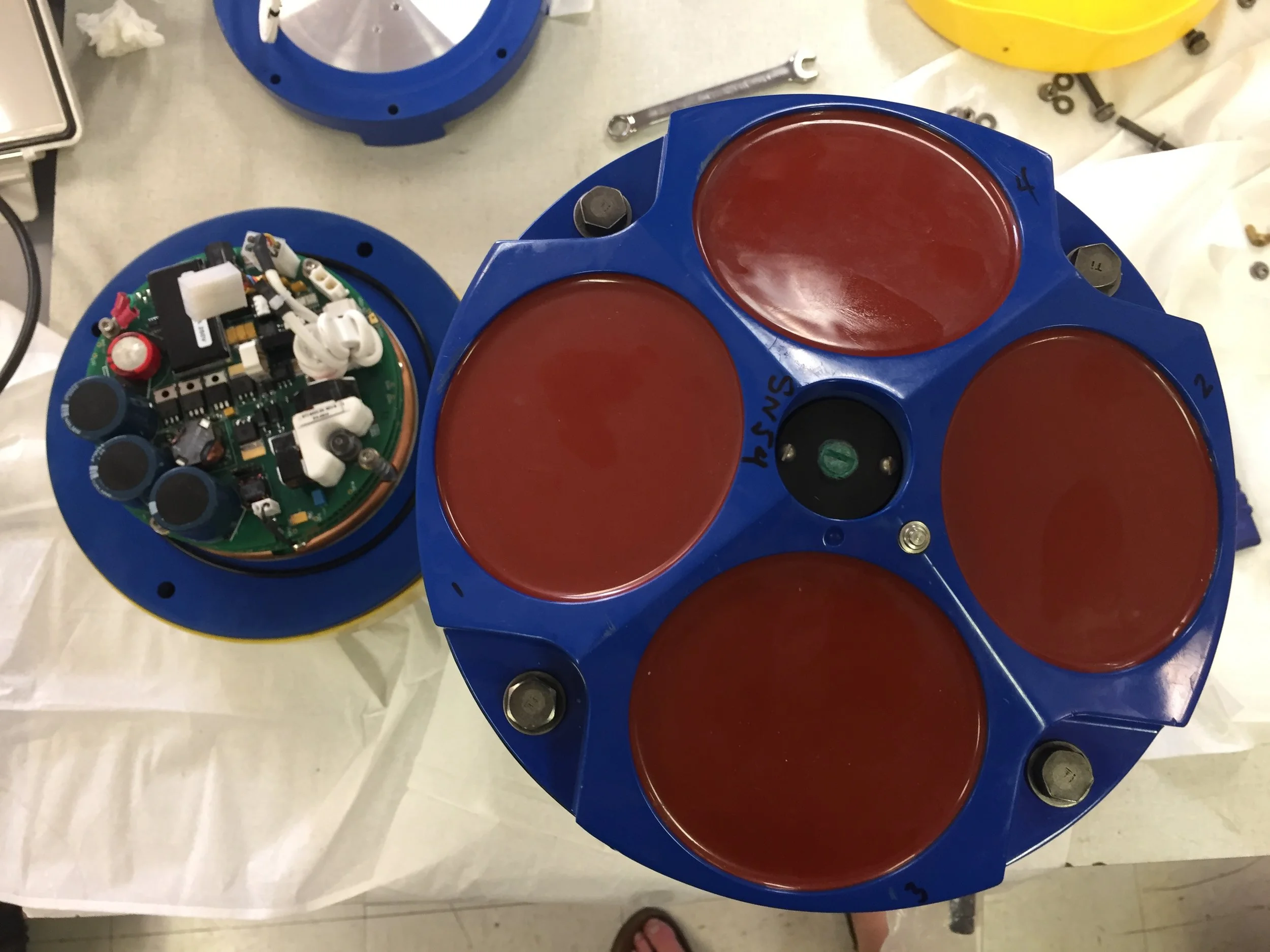
This mooring suspends a series of RBR fast temperature profilers at 10-meter increments – which will help us learn a lot about mixing in the water column at different depths. We also attached two CTDs and an Acoustic Doppler Current Profiler (ADCP) to gather data about temperature, pressure, salinity, and currents in the water. The top of the mooring has a oval float, shown here with Jonathan inspecting it. But that oval isn't providing most of the floatation. 

5X4A7411 (1).jpg

Most of the floatation is in a giant float - 3 ft in diameter. ALL OF THIS Is totally underwater, otherwise icebergs would destroy it. So how do we get it back? There is a mechanism at the bottom that has a hook that will release from the anchor when it hears a specific pattern of sound - a code. It is risky. If the release fails, we can't get the mooring and all the data back very easily (we can try to drag the bottom of the fjord for it and try to hook it from the boat).

In the photo below, Jonathan is showing off one of our small moorings, which will go right up next to the glacier. In the upper left of the photo is the giant ball that is for this deep mooring and the yellow instrument at the right is the mechanism designed to release from the anchor. 

IMG_1360 (1).JPG

The final deloyment looked like this (watch for the top float to disappear off behind the boat near the end of the video!)

I think deploying this mooring was one of my favorite parts of this trip – the whole team was involved, and everyone had to coordinate to get all the different parts of the mooring into water at the right time and place, and it was thrilling. Communication between the bridge and the deck was key because the Amber Anne had to be travelling at the right speed as we dropped in each part of the mooring. June and Johnathan worked on getting big instruments off the deck with the crane, while other members of the team radioed the bridge, kept track of when instruments were put in the water, and fed cable over the side of the boat. The best part was watching each of the instruments disappear into the water once the anchor was released.

An Oceanographer on the Rocks??

By Anna Simpson

I got to be a glaciologist for a day which means that I helped Jason carry cameras, batteries, and tripods up to the top of the high rocks above glacier terminus. We were taken to shore in a small skiff and dropped off at the base of this steep, rocky stream bed - this seemed like the best way to hike to the elevation and rocks we were trying to get to. There was no trail, but not a lot of vegetation, so it was relatively easy in terms of navigation to get to the top. We got to a saddle between the rocky cliffs at which point we left the heavy gear and scrambled around to find a good location to set up the cameras. After a bit of walking around, we found the spot - on top of large, flat rock, 220m above sea level.

glacier_fromabove.jpg

Why? Our goal was to set up two cameras positioned to take pictures of the terminus and fjord during daylight hours every 30 seconds. Time lapse photography is useful to track the movement of icebergs in the fjord, calving events, and capture movement of the terminus. It also helps us keep track of wind and rain events and anything else that might affect our data.  In this project in particular, tracking the movement of icebergs can tell us something about the surface circulation patterns in the fjord.

tripods_setup.jpg

Once we set the tripods up in a good position, we had to gather a lot of rocks (big and small) to stack around the base to keep it very still during the duration of the deployment. We also attached a GPS to the tripod and let it communicate with satellites for an hour to get a very accurate position. It’s important to have a very accurate position of the camera, so quantifiable data can be collected from the pixels in the pictures.

A particularly fun aspect of hiking up so high above the fjord was watching the ship move around (it appears so tiny amongst the high rock walls of the fjord!) and our robotic kayak pulling and successfully deploying the first mooring which was really cool to see from way up above! The following day Akua and Jason hiked up to a lower elevation closer to the terminus to set up 2 more cameras in the same way. 

1rst_ROSE_mooring_deployment.jpg
jason_ship_fjord.jpg

A few photos from Akua's adventure with Jason the next day. 

camera1.jpeg
camera2.jpeg
camera3.jpeg

Traveling Up the Leconte Fjord

by Akua McLeod

Apparently, John Muir once wrote something like you should go to Alaska when you’re young because no other place will ever live up to the beauty of Alaska’s landscape. But I am so glad that I had the chance to see this place – it is dramatic, and stunning, and made me feel very small in a way that only being surrounded by nature can.

The three-hour trip up the fjord to LeConte glacier was absolutely beautiful. When I woke up we were already on the way and I walked outside to expanses of green water, and baby ice bergs, and tree covered mountains disappearing into the clouds. I think I could have spent the whole trip at the stern of the boat – watching the trees transition to steep faces of granite and looking at the seal families that hang out on floating chunks of ice. I ran out without gloves at first, and it was chilly, but my stiff fingers were definitely worth the view. Here are some of my favorite photos:

fjordtrip1.jpeg
fjordtrip2.jpeg
fjordtrip3.jpeg

Seeing the glacier for the first time was pretty magical too and watching my first calving event was so different from anything else I’ve experienced. The LeConte Glacier is a bright blue against the rest of the landscape, and its full of arches, crags and caves made of ice.

glacier1.jpeg

Throughout the day, especially when it’s warm out, slices of ice crack and come tumbling from the face of the glacier – making sounds echoing sounds and sending rippling waves and crumbled ice throughout the fjord.

The short story? I don’t think I could ever get tired of this place.

iceberg2.jpeg
iceberg3.jpeg

Erin Pilots the Drone!!?!

by Erin Pettit

I have never really been interested in remote controlled cars and such - wasn't my thing as a kid. And I kind of took on the challenge of flying the drone because everyone else had a more important job during the first deployment. Turns out it is fun, and I'm not too bad a pilot! 

Here are a few of my drone videos. 

The best one showing the mooring deployment (sped up to 2x speed) 

If you want to see the whole video in real time, watch here. 


Landing was always a challenge. I'm still working on that - a moving boat is a tough target! 

Loading the Cargo Container... and ROAD TRIP!

by Erin

After instruments are prepped, raft designed and built, and supplies purchased, we had to load all the equipment, tools, and supplies, including the two ROSE boats, into a 20' cargo container to be shipped to Alaska. We had to keep track of what was packed in each box, and which boxes were ready to load, and figure out ways to secure odd bits, such as the giant mooring float in the photo below. 

ball.gif

Becca and Jonathan are prepping a large black bin of mooring supplies before it will be forklifted into the container. Notice the giant ball is now in the upper right of the container, ROSE is underneath it, boxes of instruments in the middle, more small mooring balls stuffed in various places. It all has to fit... tetrus with odd shapes! 

IMG_1316.JPG

Jonathan loves driving the forklift. Here he is carrying lead weights that might look small, but each weigh a couple hundred pounds - not something any of us could lift! Watch your toes...  

In the end Jonathan and I had to drive the container to Seattle. A bumpy 5 hour drive, when ended at the Alaska Marine Lines dock where a giant forklift picked the container up off our truck and took it away - to a barge to be sent off to Petersburg, Alaska. 

Pre-field Preparations at Oregon State University!

By Akua

So, what the does the prep work for a glacier expedition look like? For the past few weeks, the lab witnessed an extreme bustle of activity. The breakroom whiteboard captured the long list of activities needed to make our upcoming trip go smoothly – cataloging everything from equipment to purchase and instruments to clean, to flight information and housing logistics.

breakroom.png

I quickly learned the significance of this work. Once in the LeConte fjord, our whole team will be focused on the data collection process, so having all the equipment calibrated and organized beforehand will help make our work more focused and efficient. Seemingly small tasks done ahead of time – measuring out cable lengths and chunks of chain, calibrating compasses, programming the instruments used to collect data – can make a big difference during the actual trip, when the team will only have three days to deploy instruments and gather data.

At the top of the list this week was final testing of the Robotic Oceanographic Surface Explorers (ROSE) and building the raft that will be used to deposit our instruments at the base of the LeConte Glacier ice cliffs. During the expedition, ROSE will navigate to the terminus of the glacier with the raft in tow, carrying the instruments, floats, and anchors that will be deployed to analyze subglacial melt. These devices are the crux of the expedition, because they allow us to conduct acoustic analysis in regions too dangerous for the team to explore in person. ROSE is ultimately what will help us get close enough to the edge of the glacier to listen to ice melt at its base.

IMG_8307[1].JPG

We also needed to calibrate and program the different instruments we’ll use to collect data during the trip. For this expedition, we will be using both CTD SeaBirds and Acoustic Doppler Current Profilers (ADCPs). The SeaBirds are standard oceanographic instruments that will be used to measure the conductivity, temperature, and pressure of water in the LeConte Bay.  To gather data about the velocity of water flow within water columns at the glacier’s base, we’ll use ADCPs. Ultimately, both instruments are important and weaving the two types of data together will allow us to develop a more comprehensive understanding of how ocean water and subglacial melt interact at the ice-ocean boundary. 

IMG_8319[1].JPG
IMG_8303[1].JPG

Finally, after everything was calibrated and built, it was time to pack all our gear into the container that will meet us in Petersburg, Alaska! It was a busy, busy week and it left me with a much greater appreciation for all the ground work that must be done to make the expedition possible.

Here are a few more photos and videos of the instrument preparations.

IMG_1268.JPG
IMG_1256.JPG
IMG_1251.JPG

National Geographic Partnership

by Erin

Sound of Ice is funded by National Geographic Society. 

While National Science Foundation has been funding core research in this fjord for the last several years. This particular expedition includes a special, slightly risky, super exciting component that is funded by the National Geographic Society. We are combining Erin's work in acoustics and Jonathan's ability to make measurements with an unmanned boat to push the boundaries of science by using Jonathan's boat ROSE to actualy deploy a mooring that has hydrophone sensors on it to "listen" to the glacier, right up at the base of the ice cliffs - closer than anyone has before.   In a tribute to National Geographic's support of this project, we thought it fitting to design our mooring deployment "raft" as the classic NGS rectangle. We will add photos showing ROSE in action here soon!  

rose1.jpeg
ngsrect1.jpeg